What Is Lot Vision? How Tech Is Mapping Vehicles and Real Estate
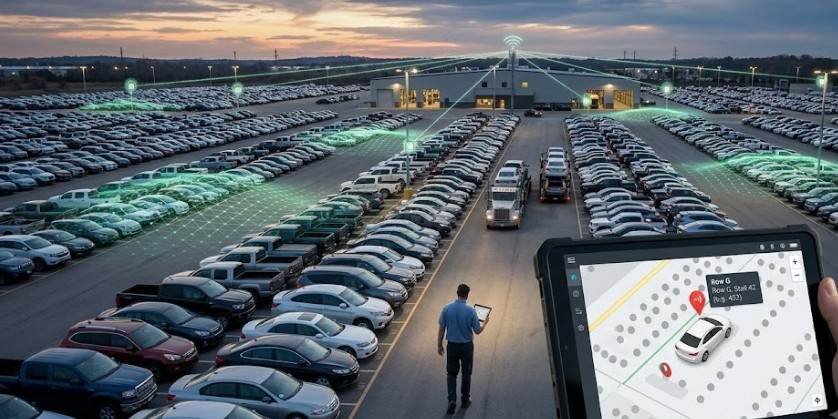
Finding a single white sedan parked somewhere inside a 200-acre automotive auction yard is like trying to find a needle in a haystack—if the haystack held 15,000 identical needles.
Lost inventory costs the wholesale auto industry millions of dollars every year in delayed sales, wasted worker hours, and frustrated logistics teams. That simple operational nightmare is why modern platforms like lot vision technology emerged.
Whether you are trying to locate a specific vehicle out of thousands at an auto auction or attempting to position a custom floor plan onto a virgin patch of land, visual mapping systems have transformed how we interact with physical property.
Here is how visual lot technology works, why it matters across two massive industries, and how you can use it to avoid expensive operational mistakes.
The Dual Identity of Lot Vision: Automotive vs. Real Estate
The phrase lot vision primarily describes two distinct technological solutions solving the exact same fundamental problem: spatial uncertainty.
┌── Manheim LotVision (Auto Logistics)
│ ├── OBD II & Steering Wheel Hardware
│ └── Real-time 10-ft Radius Tracking
LOT VISION PLATFORMS ──────────┤
└── Schumacher Homes Lot Vision (Real Estate)
├── Geographic Information Systems (GIS)
└── Satellite Parcel Floorplan Overlay
While both tools focus on positioning assets accurately on digital maps, they serve entirely different industries:
- Wholesale Auto Auctions: Large-scale commercial yards using real-time location hardware to track high-volume vehicle inventories.
- Custom Home Building: Residential software platforms enabling land buyers to visualize home placement on physical property lines before breaking ground.
1. Automotive Logistics: Tracking Vehicles in Real-Time
In wholesale automotive environments like Manheim auctions, managing inventory moves at breakneck speeds. Hundreds of cars enter, get detailed, undergo inspections, and move through auction lanes daily.
Historically, tracking relied on human lot attendants walking rows with clipboards or manual barcode scanners.
How Wireless OBD Tracking Operates
Modern vehicle location systems replace manual tracking with plug-and-play hardware. Small wireless tracking transmitters connect directly to a vehicle’s On-Board Diagnostics (OBD-II) port or attach directly to the steering wheel.
These transmitters send continuous signals to a wireless mesh network spread across the auction property.
- Precision Location: The system pinpoints the vehicle’s physical placement within a 10-foot radius.
- Access Protocols: Workers, buyers, and transporters log into a centralized portal or scan physical QR codes located at the lot to pull up interactive maps.
- Search Parameters: Users locate target inventory instantly by typing a Vehicle Identification Number (VIN) or specific Work Order number into the search bar.
- Remote Diagnostics: Because the tracking module connects to the OBD-II port, it reads engine diagnostic trouble codes (DTCs) in real time. Buyers can check battery health or active warning lights without ever opening the driver’s door.
For organizations researching vehicle hardware standards, the National Highway Traffic Safety Administration provides comprehensive regulatory safety guidelines on vehicle electronic systems.
2. Real Estate Visual Mapping: Custom Homes on Digital Parcels
The residential real estate application of visual lot technology approaches space from a completely different perspective. Platforms like Schumacher Homes Lot Vision focus on pre-construction planning rather than live asset tracking.
┌──────────────────────────┐ ┌──────────────────────────┐ ┌──────────────────────────┐
│ Enter Parcel ID / Zip │ ────> │ Satellite Layer Fetched │ ────> │ Overlay Floor Plan Model │
│ Identifies plot boundary│ │ High-resolution imagery │ │ Scale, rotate, and site │
└──────────────────────────┘ └──────────────────────────┘ └──────────────────────────┘
How Parcel Visualization Works
Building a custom house on rural land comes with significant spatial uncertainty. Homeowners often struggle to picture how a 3,000-square-foot footprint sits relative to property lines, setbacks, tree lines, or natural slopes.
- Parcel Identification: The user inputs their land address or county Parcel Identification Number (PIN).
- GIS Overlay: The software retrieves public satellite data and property boundaries managed by local government land offices.
- Interactive Placement: The user drops a scale model of their selected architectural floor plan directly onto the high-resolution image of their land.
- Spatial Adjustment: Builders can rotate the house footprint to optimize sunlight exposure, preserve mature trees, or position driveway access points before spending money on professional land surveys.
Public land boundaries depend heavily on precise municipal mapping. You can explore public spatial data standards directly through the U.S. Geological Survey, which manages national topographic and geographical framework data.
Auto Tracking vs. Land Visualization: A Quick Comparison
| Feature | Automotive Lot Tracking (e.g., Manheim) | Real Estate Lot Mapping (e.g., Schumacher) |
| Primary Goal | Locate physical vehicles across vast lots | Position house floor plans onto land parcels |
| Primary Users | Auto dealers, transporters, auction staff | Custom home buyers, land developers, architects |
| Core Technology | OBD-II wireless dongles, bluetooth/cellular mesh | GIS boundary mapping, satellite imaging |
| Key Metric | Real-time distance (10-ft accuracy radius) | Scale geometry, boundary setbacks, cardinal orientation |
| Bonus Data | DTC diagnostic codes, vehicle battery health | Terrain orientation, visual parcel boundaries |
Practical Checklist: Using Visual Mapping Tech Effectively
Whether managing a fleet of auction cars or building a dream home, taking full advantage of spatial mapping tools requires a deliberate approach.
For Auto Auction & Logistics Managers
- Verify Port Connections: Ensure tracking dongles click fully into the OBD-II receiver to avoid false diagnostic reports.
- Cross-Check Work Orders: Search by full 17-digit VINs rather than partial numbers to avoid duplicate model matches.
- Review DTC Codes Early: Check vehicle trouble codes inside the portal before dispatching transport trucks.
For Custom Home Builders & Buyers
- Obtain Your Official Parcel ID: Retrieve your exact tax PIN from your county assessor’s office for precise plot boundaries.
- Check Local Setback Rules: Confirm local zoning setback requirements (minimum distances from property lines) before finalizing placement.
- Account for Topography: Remember that 2D satellite views do not show steep elevation changes, rock outcroppings, or marshland.
Frequently Asked Questions
1. What is lot vision?
Lot vision refers to spatial mapping technologies used either to track vehicles in real time on auto auction lots or to digitally position home floor plans onto land satellite maps.
2. How much does Lot Vision cost to use?
For auto auction buyers and home builders, accessing these software portals is typically free. Transporters scan lot QR codes directly, while home design tools are included within builder web platforms.
3. Is Lot Vision better than other tracking systems?
Yes, for auction environments. Unlike static GPS units or manual barcode sweeps, OBD-connected lot tools update locations within 10 feet while simultaneously delivering real-time vehicle health diagnostics.
4. What is “lot vision” in real estate?
In real estate, it refers to interactive software that overlays custom digital house blueprints directly onto satellite imagery of specific property parcels to plan site layout before construction.
Mastering Spatial Technology in Business
Spatial tracking and parcel visualization tools have fundamentally changed how we manage physical property. By replacing guesswork with real-time diagnostic data and geographic precision, these platforms eliminate costly delays across both wholesale automotive yards and custom construction sites.
As location technology continues to evolve, integrating live spatial tools into your workflow ensures you spend less time searching for assets and more time making informed decisions.

Related Posts

Cyberbackgroundchecks Exposed: How Your Private Life Ended Up Online and How to Scrub It

Mastering MyKaty Cloud: The Ultimate Access & Security Guide for Katy ISD Families