

The Importance of Land Surveyors in Property Development
Land surveying plays a critical role in the process of property development. It is a specialised discipline that involves measuring and mapping land boundaries, which provides the foundational data necessary for successful construction and development projects. Without accurate land surveys, developers risk costly errors, legal disputes, and project delays.
What Is Land Surveying?

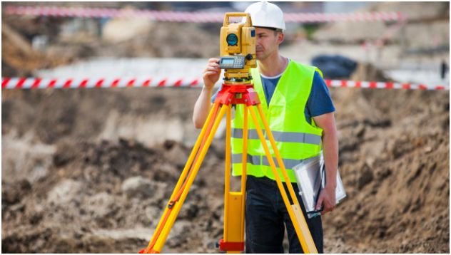
Land surveying is the science and art of determining the terrestrial or three-dimensional positions of points and the distances and angles between them. These points are often used to establish land maps and boundaries for ownership or governmental purposes. Surveyors use a variety of technologies, including GPS, total stations, and drones, to collect precise data about the land.
The Role of Land Surveyors in Property Development
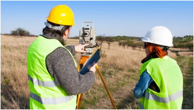
Land surveyors provide essential information that guides planners, architects, engineers, and property developers. Their expertise ensures that the layout of buildings, roads, and utilities properly fit within the designated plot and comply with zoning laws and regulations. This reduces the likelihood of disputes with neighbours or regulatory authorities.
The process typically begins with a site survey, where land surveyors assess the physical characteristics of a site. They identify natural features such as trees, rivers, and slopes, along with existing structures. This is fundamental to informed design and environmental conservation.
Legal Boundaries and Land Titles
One of the primary responsibilities of land surveyors is to accurately establish property boundaries. Inaccurate delineation can lead to boundary disputes, infringements on adjacent properties, or difficulties obtaining necessary building permits. Detailed survey maps provided by professional land surveyors act as legal documents in property transactions and development approvals.
Surveying and Compliance with Regulations
Developers must adhere to a range of local and national standards including zoning laws, building codes, and environmental regulations. Land surveyors help ensure compliance by providing data that aligns with these requirements. For example, surveys can identify flood zones or protected land which might restrict development options.
Surveys also determine topographic changes and gradients which influence drainage planning and foundation design. These aspects are crucial for safe and sustainable construction practices. The early involvement of surveyors minimises the risk of costly redesigns or non-compliance penalties.
Technological Advances in Land Surveying
Modern land surveying incorporates advanced technology such as Geographic Information Systems (GIS), LiDAR scanning, and Unmanned Aerial Vehicles (UAVs). These tools enable a higher degree of accuracy and faster data collection compared to traditional methods.
Surveyors can now produce detailed 3D models of terrain and infrastructure, assisting developers and planners in visualising the project to turn it into blueprint to reality prior to construction. Advances in technology continue to enhance the quality of land surveys, making them indispensable in complex property development projects.
Economic Benefits of Engaging Land Surveyors

Accurate land surveying can lead to significant cost savings during property development. Clear and precise surveys prevent design errors that cause rework or legal complications. This efficiency shortens project timelines and reduces expenses related to litigation or redevelopment.
Furthermore, reliable land surveys ensure the optimal use of land, maximising the value of the property. Developers can make informed decisions about boundaries, plot subdivision, and infrastructure placement, ultimately increasing return on investment.
Case Study: Engaging Professional Land Surveyors
Consider a property development project that commenced without professional land surveying. The absence of accurate boundary identification led to an inadvertent encroachment onto neighbouring land. This resulted in a legal dispute causing project delays and additional costs.
By comparison, engaging Land Surveyors from the outset helps to prevent such issues. Their expertise in site analysis and legal boundary determination safeguards the project and builds confidence among all stakeholders.
Conclusion
Property development is a complex undertaking that requires precise information about land boundaries and topography. Professional land surveyors contribute indispensable services by providing accurate measurements and detailed mapping, supporting regulatory compliance and informed decision-making.
Their involvement reduces risks associated with boundary disputes, non-compliance, and design errors. Technological innovations continue to enhance the efficiency and quality of surveying, firmly establishing land surveyors as essential contributors to successful property development.